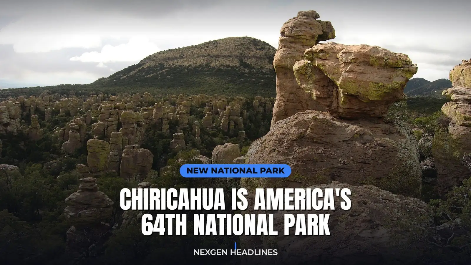

Update (Oct. 26, 2026): The park is open as usual under its new name. The Park Service fees page now reads “Chiricahua National Park” and confirms there are still no entrance or parking fees.
Quick answer: Chiricahua National Park is America’s 64th national park. President Trump signed the law on Oct. 20, 2026, renaming Chiricahua National Monument near Willcox, Arizona. Entry is free, the boundaries did not change, and the best time to go is spring or fall, before the crowds find it.
| Question | Answer |
|---|---|
| Is it a national park now? | Yes, since Oct. 20, 2026 (64th in the U.S., 4th in Arizona) |
| Where is it? | Cochise County, southeastern Arizona, near Willcox |
| Entrance fee | None. No entrance or parking fees, per NPS |
| Size | About 12,000 acres, same boundaries as the monument |
| Drive from Tucson | Roughly two hours |
| Visitors last year | Roughly 70,000 |
| Best seasons | Spring and fall |
How to plan a trip in 5 steps
- Pick your season. Spring and fall are mild. July and August bring monsoon storms.
- Book a campsite or a room early. Bonita Canyon Campground is small. Willcox has the closest motels.
- Check alerts on nps.gov/chir the week you go. Trails can close after storms or ice.
- Fill up in Willcox. Gas, food and cell service are limited near the park.
- Start hikes early and carry more water than you think you need.
There is a corner of southeastern Arizona where thousands of stone columns stand shoulder to shoulder on the hillsides, some of them balancing boulders that look as if a strong breeze would tip them over. As of this week, it is America’s newest national park.
President Trump signed the Chiricahua National Park Act on October 20, 2026. Chiricahua National Monument, protected since 1924, is now Chiricahua National Park: the 64th national park in the United States and the fourth in Arizona.
It is also one of the least crowded. Roughly 70,000 people visited last year, a tiny fraction of the millions who go to the Grand Canyon. That is likely to change, so if you want to see it quietly, the next year or two is your window.
The short version
- Signed into law: October 20, 2026
- Where: near Willcox in Cochise County, southeastern Arizona
- Size: about 12,000 acres, with the same boundaries as the old monument
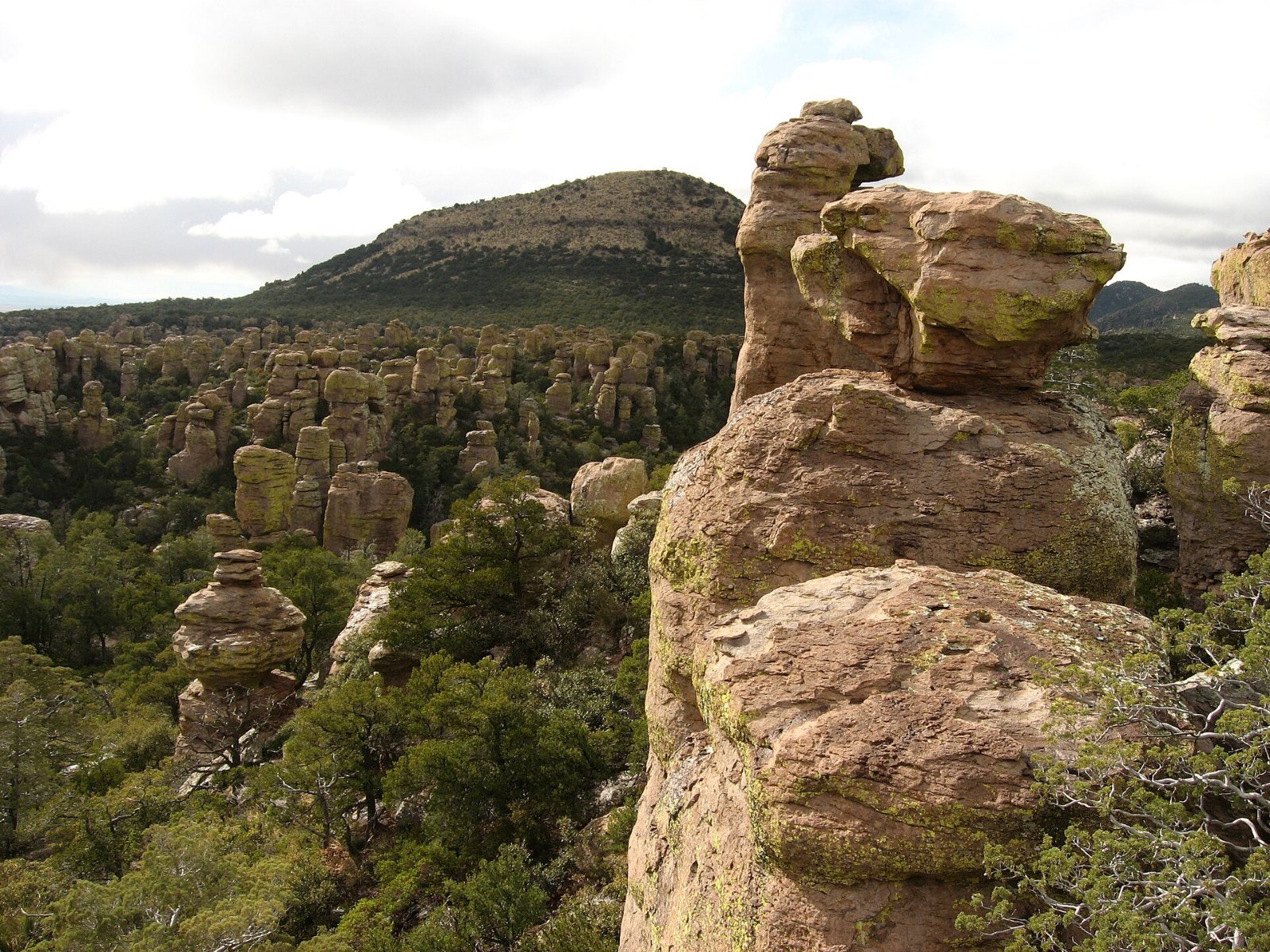
- Known for: rhyolite rock spires and balanced rocks formed about 27 million years ago
- Ranking: 64th national park in the U.S., fourth in Arizona, first new park in about six years
- What stays the same: the trails, campground, scenic drive and tribal access protections
Short on time? See the key points in our web story.
What actually changed on October 20
Mostly the name, and the attention that comes with it.
Chiricahua has been managed by the National Park Service for more than a century, so the rangers, trails and visitor center are the same people and places they were last week. The park keeps its existing boundaries, and the law keeps protections for tribal access in place.
What the “national park” label brings is a spotlight. Interior Secretary Doug Burgum said the designation will “shine a national spotlight on one of Arizona’s hidden gems,” and described its “towering rock spires, rich Apache heritage and remarkable biodiversity.” He has also said the park will need more staff and infrastructure to handle the visitors that are expected to follow.
Jessica Bowron, who is exercising the delegated authority of the Park Service director, put the continuity plainly: “While its name is changing, our commitment remains the same.”
For nearby towns like Willcox, the hope is simple. National park status tends to put a place on bucket lists, and that means more hotel nights, restaurant meals and gas station stops.
Why the rocks look like that
About 27 million years ago, a massive volcanic eruption from what geologists call the Turkey Creek caldera blanketed the area in hot ash. The ash welded into a hard rock called rhyolite.
Over millions of years, water and ice worked into the cracks in that rock. The softer parts wore away, and what was left are the columns, pinnacles and perched boulders you see today. Apache people called the area the “Land of Standing-Up Rocks,” and it is hard to think of a better description.
A sky island, not just a desert park
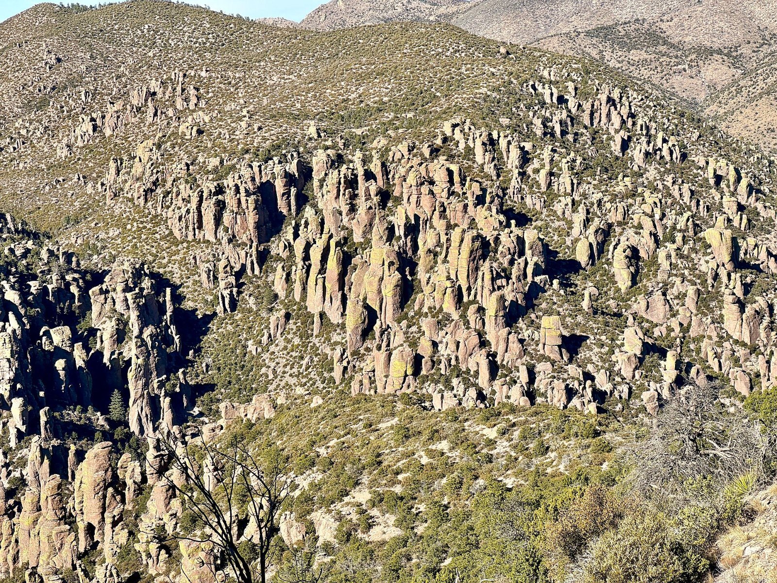
Chiricahua sits in what ecologists call a “sky island”: a mountain range rising out of the desert and grassland, high enough to hold forests of oak, juniper and pine near the top. Several different worlds meet here: the Sonoran and Chihuahuan deserts, the Rocky Mountains and Mexico’s Sierra Madre.
That mix makes it one of the best wildlife and birding spots in the Southwest. Birders come for species that are rare elsewhere in the U.S., and the area is known for coatimundi, javelina and a wide range of reptiles.
It is also a dark-sky destination. Far from big cities, the night sky here is spectacular, and stargazing is one of the activities the Park Service highlights.
The human story
The Chiricahua Mountains are the homeland of the Chiricahua Apache, the people of Cochise and Geronimo. The park preserves thousands of years of human history, and the new law keeps protections for tribal access to the land.
Later, homesteading families settled in the canyon. Faraway Ranch, near the park entrance, preserves the story of one of those families, who later ran the ranch as a guest ranch for visitors coming to see the rocks.
The best things to see and do
Bonita Canyon Drive and Massai Point
The scenic drive climbs about eight miles from the visitor center up to Massai Point, the classic overlook. From the top you can see across the rock spires to the valleys on both sides. If you only have an hour, this is the drive to do.
Echo Canyon Loop
A moderate loop of roughly three miles that takes you down among the spires rather than just looking at them from above. It is the trail most first-time visitors remember.
Heart of Rocks
The big day hike. It is a longer, harder trip into the area with the most famous balanced rocks, including Big Balanced Rock and Punch and Judy. Start early, carry plenty of water and check trail conditions at the visitor center first.
Sugarloaf Mountain
A short but steep climb to a fire lookout with one of the widest views in the park.
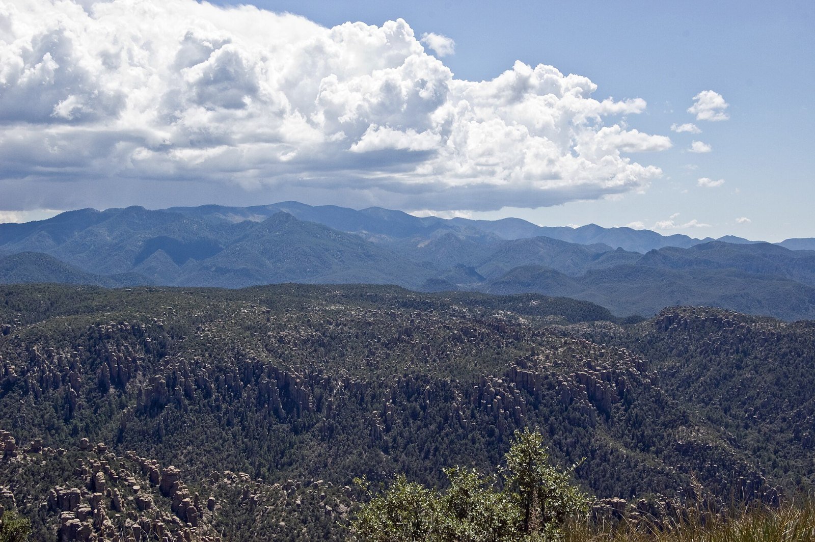
Planning your visit
| What | Details |
|---|---|
| Address | 12856 E Rhyolite Creek Rd, Willcox, AZ 85643 |
| Phone | 520-824-3560 (visitor center, 8:30 a.m. to 4:30 p.m. daily) |
| Nearest town | Willcox, Arizona |
| Drive from Tucson | Roughly two hours |
| Camping | Bonita Canyon Campground inside the park; book ahead |
| Best seasons | Spring and fall |
| Watch for | Summer monsoon storms (July to August), winter ice on high trails |
A few practical tips:
- Fill up on gas and groceries in Willcox. Services inside and right around the park are very limited
- Do not rely on your phone. Cell service is patchy; download offline maps before you leave town
- Elevation is real. The higher trails sit well above 6,000 feet. Go slower than you would at sea level and drink more water
- Check fees and alerts on nps.gov/chir before you go. Name changes do not automatically change entrance fees, and an America the Beautiful pass covers Park Service entrance fees where they apply
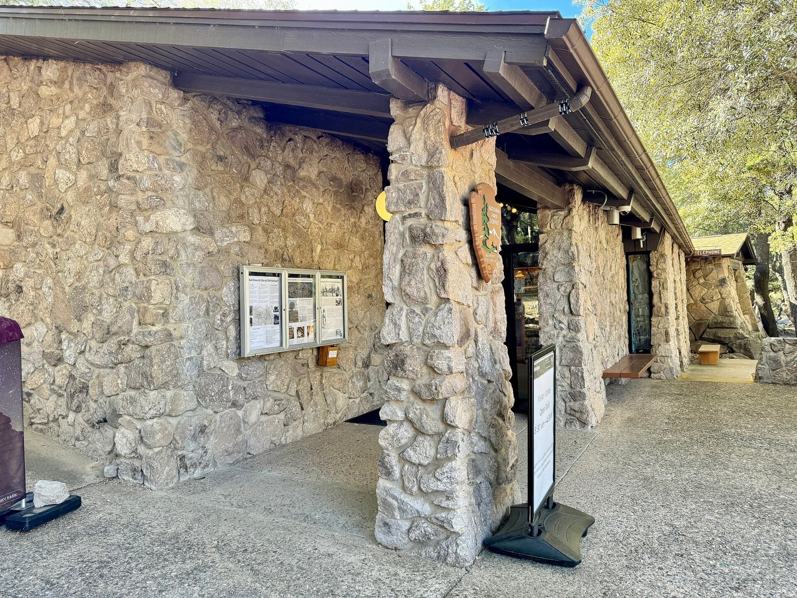
Should you go now?
If you like your national parks quiet, yes. Every new national park sees a jump in visitors once it shows up on park-collecting lists and in travel features, and Chiricahua’s small campground and narrow scenic road are not built for crowds.
Fall is a particularly good time. The summer storms have passed, temperatures are mild, and the light on the rocks in the late afternoon is the reason photographers keep coming back.
If you are planning a holiday road trip, our guide to cheap Thanksgiving and Christmas flights covers getting to Tucson or Phoenix without overpaying.
Fees, passes and camping: what it costs
The new name did not bring a gate fee. The Park Service says Chiricahua does not charge entrance or parking fees, and you do not need a pass to drive in.
Camping is separate. Bonita Canyon Campground is small, and sites are booked through Recreation.gov. Check its page for the current rate, open dates and vehicle limits, or call the visitor center at 520-824-3560.
The national forest land around the park is run by the U.S. Forest Service. Some of those areas may charge their own fees.
How the law got passed
The Chiricahua National Park Act had support from both parties. The House passed it by voice vote in March 2026. The Senate agreed by unanimous consent before the president signed it on Oct. 20.
The law changes the name and the status. It does not change the boundaries, and it keeps protections for tribal access to traditional cultural and religious sites. It does not, by itself, add federal money.
It is the first new national park in about six years. The last one before it was New River Gorge in West Virginia, in December 2020.
A sample one-day and two-day plan
These are made-up sample plans to help you picture a visit. Check trail conditions before you go.
| Plan | Morning | Afternoon |
|---|---|---|
| One day from Tucson | Leave by 7 a.m. Visitor center, then Echo Canyon Loop | Bonita Canyon Drive to Massai Point; head back before dark |
| Day 1 of 2 | Drive in, stop at the visitor center and Faraway Ranch | Echo Canyon Loop; sunset light at Massai Point |
| Day 2 of 2 | Heart of Rocks hike, with an early start | Short Sugarloaf Mountain climb; stargaze after dark |
Made-up example: A couple from Phoenix plans a fall weekend. They book a campsite three weeks ahead, fill up the tank in Willcox, and download offline maps. They hike Echo Canyon on day one and Heart of Rocks on day two. Their only fees are gas, food and the campsite.
Mistakes first-time visitors make
- Arriving at midday in summer. Afternoon storms and heat cut hikes short. Start early.
- Counting on cell service. It is patchy. Print or download your map.
- Underestimating the altitude. Upper trails sit above 6,000 feet. Pace yourself.
- Showing up without a campsite. The campground is small. Book ahead, or call before you count on a walk-up site.
- Leaving the tank half full. Services are limited near the park. Fill up in Willcox.
Nearby stops worth adding
- Fort Bowie National Historic Site: a short drive north. A walking trail leads to the ruins of the Army post and Apache Pass.
- Willcox: the nearest town, with motels, diners and a growing wine-tasting scene.
- Cochise Stronghold: in the Dragoon Mountains to the west, tied to the Chiricahua Apache leader Cochise.
Also read: How to find cheap Thanksgiving and Christmas flights to Tucson or Phoenix.
Frequently asked questions
Is Chiricahua a national park now?
Yes. President Trump signed the Chiricahua National Park Act on October 20, 2026, redesignating Chiricahua National Monument in southeastern Arizona as Chiricahua National Park.
What number national park is Chiricahua?
It is the 64th U.S. national park and the fourth in Arizona, after Grand Canyon, Petrified Forest and Saguaro. It is the first new national park in about six years.
Where is Chiricahua National Park?
In Cochise County, southeastern Arizona, near the town of Willcox. The visitor center is at 12856 E Rhyolite Creek Road, Willcox, AZ 85643. It is roughly a two-hour drive from Tucson.
What is Chiricahua known for?
Its forests of rhyolite rock spires, called hoodoos, and balanced rocks formed by a volcanic eruption about 27 million years ago. It is also a sky island with unusual biodiversity, the homeland of the Chiricahua Apache, and home to historic Faraway Ranch.
Does Chiricahua National Park charge an entrance fee?
Check the fees page at nps.gov/chir before you go. A change of name from monument to park does not by itself set new fees, and an America the Beautiful pass covers National Park Service entrance fees where they apply.
When is the best time to visit Chiricahua?
Spring and fall are the most comfortable for hiking. Summer brings heat at lower elevations and monsoon thunderstorms, usually in July and August. Winter can bring snow and ice to the higher trails.
Bottom line
Chiricahua became America’s 64th national park on Oct. 20, 2026. Almost nothing changed on the ground: same trails, same rangers, same free entry. What will change is the crowd size. If you want the spires and the dark skies to yourself, go this fall or next spring, book your campsite early, and fill up in Willcox.
Last reviewed: Oct. 26, 2026
Sources: National Park Service: Chiricahua fees and passes, U.S. Department of the Interior, Associated Press via Anchorage Daily News, KOLD, AZFamily, KTAR.